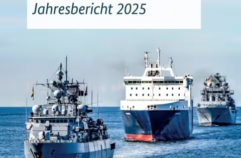
Rostock – – November 03, 2026 -- The German Navy Command has published its annual report "Maritime Dependencies of Germany" for 2025, warning that attacks on the Strait of Hormuz hit Germany "hard and directly" despite a 6,500-nautical-mile distance to the Port of Hamburg.
The Naval Shipping Management in Hamburg compiled the report. It bundles analysis and data on maritime security, seaborne trade, German seaports, global shipbuilding and the merchant fleet.
Vice Admiral Deertz puts the Hormuz–Hamburg voyage at three weeks
Vice Admiral Axel Deertz, Deputy Inspector of the Navy and Commander of the Fleet, writes in the foreword that a freighter needs about three weeks to cover the 6,500 nautical miles between the Strait of Hormuz and Hamburg. He calls the strait a lifeline of world trade.
Report adds a current-events chapter for the first time
The report normally covers the previous, completed year. This edition adds a chapter titled "Aktuelles" (Current Developments) that goes beyond the 2025 reporting period to cover the current year. Its sources include international organisations, specialist institutes and port companies, which release annual data only gradually during the following year. The 2025 edition therefore appears in autumn 2026.
Expert contributions cover Arctic competition and Russia's shadow fleet
Expert contributions assess great-power competition in the Arctic and outline legal options for countering Russia's shadow fleet.
The report describes Germany as resource-poor and heavily export-oriented, and therefore especially dependent on reliable, secure sea lanes. It states that defence capability and deterrence require supplies, energy and goods to arrive reliably by sea. The global merchant fleet is a strategic resource for supplying Europe, particularly in crises and conflicts.
Naval Shipping Management links civilian shipping and the Navy
The Hamburg unit belongs to the Navy Command and coordinates with the Maritime Security Centre in Cuxhaven, German shipping companies and ports. It works with NATO partners on Naval Co-Operation and Guidance for Shipping (NCAGS) and the Allied Worldwide Navigation Information System (AWNIS). The report is available as a free download.