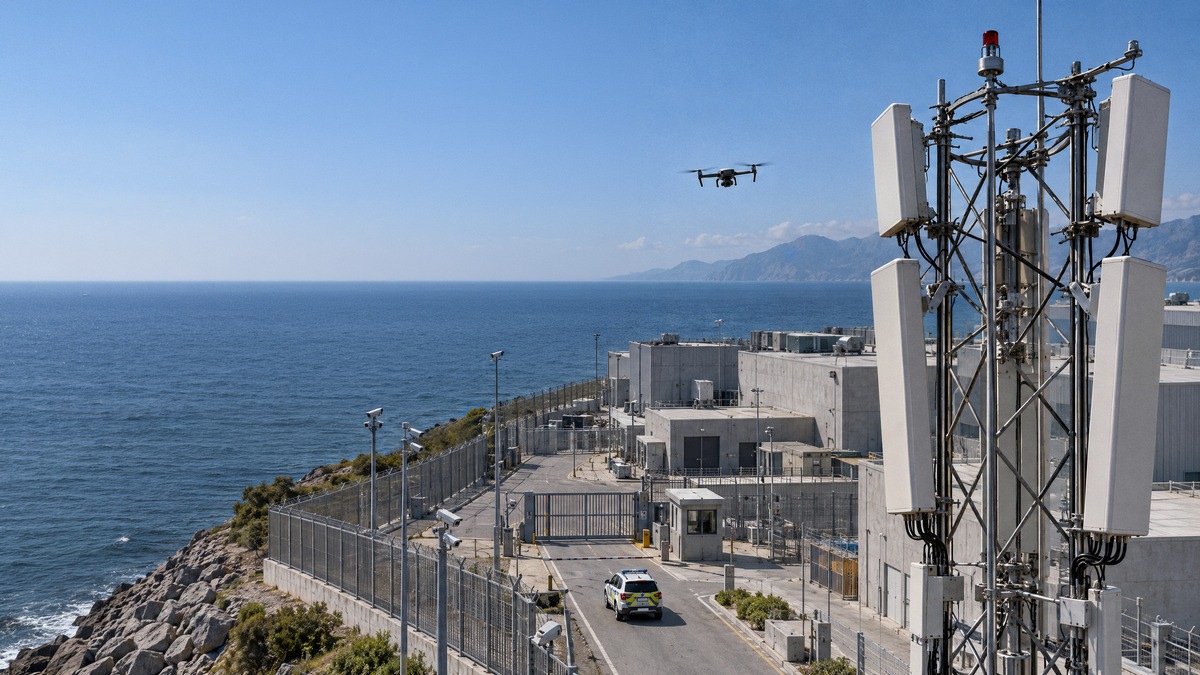
Düsseldorf – November 02, 2026 -- Ericsson will begin commercial pilots of its new Integrated Sensing and Communication (ISAC) system with selected customers in 2027, with broader deployments from 2028. The system adds sensing functions to existing 5G networks so they can detect and track low-flying drones, including ones not connected to the network.
The rollout is phased. The 2027 pilots will be smaller and focus purely on sensing. Integrated communication functions are to follow as the solution evolves toward 6G. Target customers are operators of critical infrastructure and players in defense and public safety.
Existing 5G sites replace new sensor build-outs for wide-area coverage
Small, low-cost drones are increasingly used for illegal surveillance, organized crime, sabotage and armed conflict. Their size and low-altitude flight make them hard to detect. Specialized sensors remain important for sensitive sites, but scaling them across wide areas would require extensive new infrastructure.
Ericsson's system works with 5G radio sites that have sensing capabilities, plus edge computing, artificial intelligence and signal processing. It complements radar and other sensors rather than replacing them. It reuses towers, backhaul connections and spectrum already present in cities, along transport corridors and at strategic locations.
Multistatic design tracks objects from several angles at once
The system analyzes how radio signals are reflected by objects in the environment. Sensing signals are sent and received across several geographically separated cell sites, so a target is observed from multiple angles simultaneously. Ericsson says this raises detection reliability, positioning accuracy, seamless tracking and coverage assurance.
Tracking data and AI-based classification can be passed over standardized interfaces to authorized external systems, such as command-and-control platforms.
In validation tests, the system reliably detected micro-drones over distances in the kilometer range and tracked them with precise 3D positioning. Detection and tracking held up across different operating conditions, system configurations and flight patterns. Ericsson cautions that actual performance depends on target characteristics and flight profile, sensor geometry, terrain, environment and system configuration.
AT&T, Erillisverkot and Play field trials demonstrate multi-drone tracking
In tests with AT&T in Arlington, Texas, sensor dashboards displayed drone activity in real time. Multiple drones were detected, located and tracked. AT&T's Shawn Hakl, SVP and Head of Product at AT&T Business, pointed to stadium-type environments, where installing sensors or cameras in advance may be impractical or unwanted.
A demonstration with Finnish operator Erillisverkot in Helsinki showed several 5G sites detecting and tracking drones, extending the coverage of conventional sensors for counter-UAS efforts. Erillisverkot CTO Antti Kauppinen described the technology as dual-use and said the two companies are examining how to develop it responsibly to strengthen Finland's resilience.
In Poland, Ericsson, Asseco and mobile operator Play combined Ericsson's ISAC technology, Play's network and Asseco's PUSZCZYK acoustic detection system. The setup supported more precise detection and location of low-flying drones.
Ericsson targets four use-case areas from border security to low-altitude economy
- Defense and public safety: airspace monitoring along borders, coastlines and around strategic facilities.
- Critical infrastructure: protection of ports, power plants and other key assets.
- Transport and industry: safer road, rail and industrial operations.
- Low-altitude economy: drone traffic management, urban airspace monitoring, and digital twins for smart-city planning and mapping.
Analyst sees cost and speed advantage over dedicated sensor networks
Joe Madden, Principal Analyst at Mobile Experts, said Ericsson's large installed base of sites gives it the potential to deliver wide-area drone detection faster and at lower cost than building dedicated sensor infrastructure.
Freddie Södergren, Global Head of Mission Critical Networks and Defense at Ericsson, said the system also lets network operators offer new services on their existing infrastructure. Carl Lundqvist, Chief Architect at the Swedish Armed Forces headquarters, said a distributed infrastructure complementing existing sensors could add an important layer to the situational picture.